Indian State and Union Territory
Indian State - Tripura
Tripura: At a Glance
Tripura is a state in North-East India which borders Bangladesh, Mizoram and Assam. It is surrounded by Bangladesh on its north, south and west: the length of its international border is 856 km (84 per cent of its total border). It shares a 53 km long border with Assam and a 109 km long border with Mizoram. The state is connected with the rest of India by only one road (NH-44) that runs through the hills to the border of Karimganj District in Assam and then winds through the states of Meghalaya, Assam and North Bengal to Calcutta.
At the time of Tripura's merger with effect from October 15 1949 with the Indian Union, the major mode of farming was shifting cultivation or 'jhum', which produced little surplus. A small proportion of the plain lands of the State were under settled agriculture undertaken by Bengalis, and the main crop was rice. Most of the plain lands of the State were not under cultivation and were covered with cane-brakes and marshes. Thus at the time of formation of the State, the economy was predominantly agricultural and forest-based, with no industrial base, a low level of urbanization and limited infrastructure.
Tripura Map
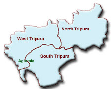
Tripura Districts List
| |||||||||||||||||||||||||||||
No comments:
Post a Comment